UN
6 Kirkstone Avenue
£ 190,000
Description
We don't have a Description for this property.
- Bedrooms
- 2
- Bathrooms
- 0
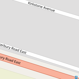


Leaflet © OpenStreetMap contributors
The heatmap indicates the level of crime in the area. The color of the heatmap indicates the crime severity and recency.
Metrics Year-on-Year
- Average area value
- 279,983.00 £Decreased by 14.38 %
- Average area rental value
- 1,013.00 £/moDecreased by 7.91 %
- Est rental Yield
- 4.34 %Increased by 7.43 %
- Crime Rate
- 10.00 %Unchanged by 0.00 %
from 327,013.00 £
from 1,100.00 £/mo
from 4.04 %
from 10.00 %
Nearby Schools
| Name | Type | Ofsted | Distance |
|---|---|---|---|
| Chilton Primary School | Academy Converter | Outstanding | 0.93 KM |
| Newington Children'S Centre | Children's Centre | 0.97 KM | |
| Newington Community Primary School | Community School | Outstanding | 1.07 KM |
| Laleham Gap School | Foundation Special School | Good | 1.56 KM |
| Ramsgate Arts Primary School | Free Schools | Good | 1.78 KM |
Images
Nearby Streets
| Name | Average Price | Average Sqft | Distance |
|---|---|---|---|
| Grasmere Avenue | £ 324,950 | 0 | 0.00 KM |
| Garden Drive | £ 0 | 0 | 0.00 KM |
| Staner Court | £ 127,500 | 0 | 0.00 KM |
| Leigh Road | £ 0 | 0 | 0.00 KM |
| King Charles Avenue | £ 280,000 | 0 | 0.00 KM |
Nearby Transport
| Name | NLC | TLC | Distance |
|---|---|---|---|
| Ramsgate | 5023 | RAM | 2.46 KM |
| Dumpton Park | 5034 | DMP | 4.67 KM |
| Margate | 5018 | MAR | 5.63 KM |
| Broadstairs | 5006 | BSR | 6.05 KM |
| Westgate-On-Sea | 5195 | WGA | 7.16 KM |
Nearby Listings
| Address | Price | Type | Score | Distance |
|---|---|---|---|---|
| Kentmere Avenue, Ramsgate, Kent, CT11 | £ 325,000 | BUY | 7 / 10 | 0.17 KM |
| Windermere Avenue, Ramsgate, Kent, CT11 | £ 325,000 | BUY | 7 / 10 | 0.27 KM |
| Derwent Avenue, Ramsgate, Kent, CT11 | £ 375,000 | BUY | Unknown | 0.29 KM |
| Borrowdale Avenue, Ramsgate | £ 335,000 | BUY | 6 / 10 | 0.35 KM |
| Windermere Avenue, Ramsgate | £ 345,000 | BUY | 7 / 10 | 0.37 KM |
Nearby Properties
| Address | Price | Distance |
|---|---|---|
| 14 Kirkstone Avenue | £ 198,500 | 0.00 KM |
| 15 Kirkstone Avenue | £ 182,000 | 0.00 KM |
| 3 Kirkstone Avenue | £ 315,000 | 0.00 KM |
| 11 Kirkstone Avenue | £ 270,000 | 0.00 KM |
| 7 Kirkstone Avenue | £ 197,500 | 0.00 KM |